
 1 hour ago
9
1 hour ago
9
Millions of people across Texas, Louisiana and Mississippi are under flood alerts this week as days of heavy rain raise the risk of dangerous flash flooding across the Gulf Coast and Lower Mississippi Valley.
Forecasters warn some areas could receive several inches of rain in just a few hours, overwhelming drainage systems, flooding roads and triggering water rescues in the hardest-hit locations.
The threat is particularly concerning because many areas have already received significant rainfall, leaving the ground unable to absorb much additional water. Forecasters warn that even neighborhoods that do not typically flood could experience dangerous conditions if storms repeatedly move over the same locations.
Where Flood Alerts Are in Effect
Texas Faces Highest Rainfall Totals
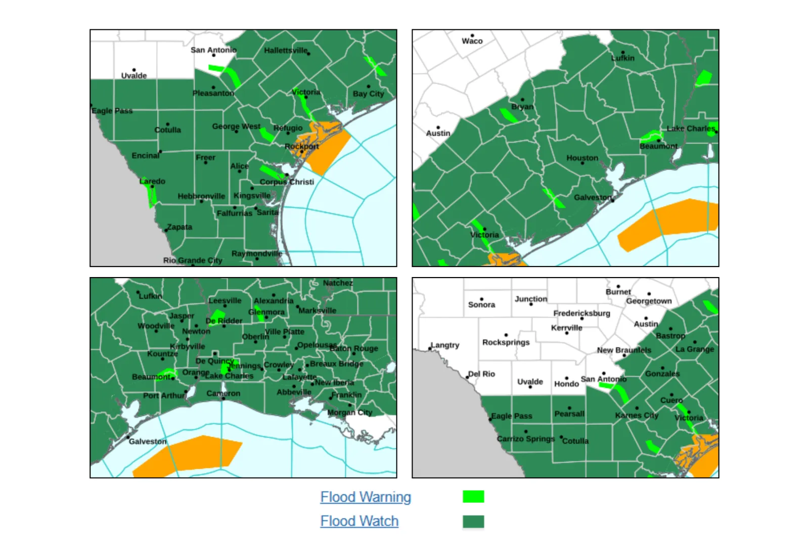
Texas remains at the center of the flooding threat. Flash flood warnings were issued overnight for parts of South Texas, while broader flood watches cover large areas of south, southeast and south-central Texas through Thursday.
Some locations have already received between 4 and 6 inches of rain, with an additional 4 to 10 inches possible in parts of the state. Isolated areas could see more than 12 inches if storms repeatedly track over the same locations. Rainfall rates may exceed 2 to 5 inches per hour in the strongest storms.
Louisiana Braces for Days of Heavy Rain
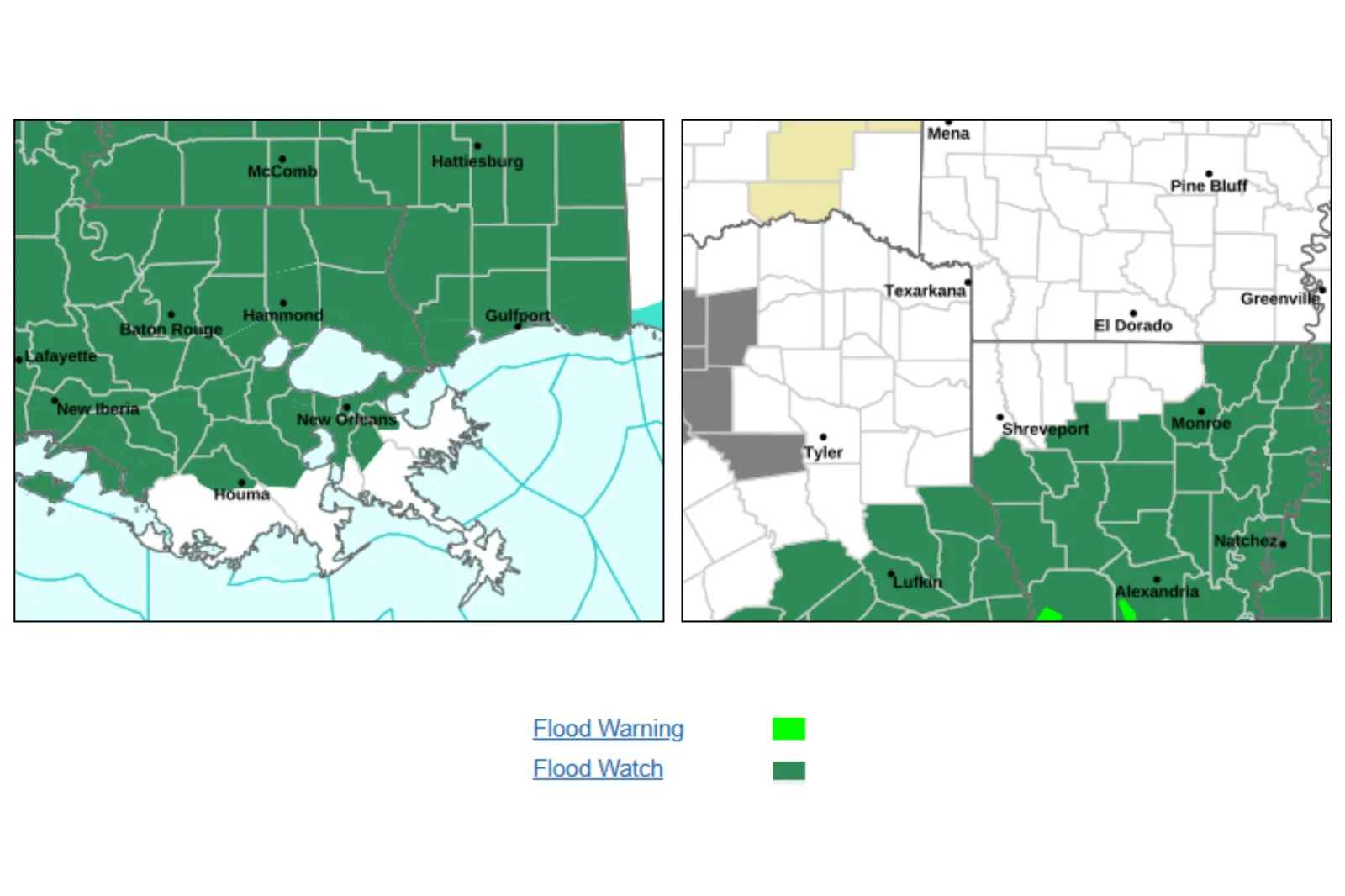
Flood watches cover much of Louisiana, with the threat expected to continue through at least Thursday and, in some areas, Friday. Forecasters expect multiple rounds of thunderstorms capable of producing widespread rainfall totals of 3 to 6 inches, with locally higher amounts possible.
Officials are also monitoring river levels, including the Mermentau River, which is forecast to reach minor flood stage later this week.
Mississippi Also at Risk
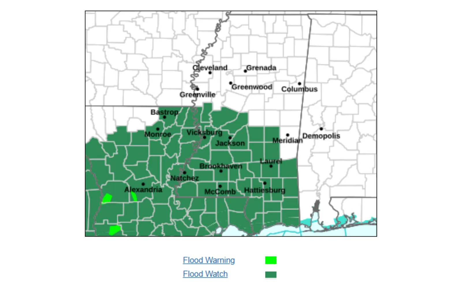
Flood watches remain in effect across large portions of Mississippi through Thursday as repeated thunderstorms increase the risk of flash flooding.
The NWS warns that 3 to 5 inches of rain could fall in a short period, with locally higher totals possible.
What's Driving the Flood Threat?
Meteorologists say several factors are combining to create a dangerous setup, including saturated ground, repeated thunderstorms and exceptionally high rainfall rates.
Rainfall rates of 2 to 4 inches per hour are possible in stronger storms, while widespread totals of 4 to 6 inches are expected across parts of the region through Thursday.
Some areas—particularly along the Texas Gulf Coast—could see significantly higher amounts where storms repeatedly move over the same locations, increasing the risk of flash flooding.
What Could Happen?
The National Weather Service warns that excessive runoff could flood roads, neighborhoods, rivers and low-lying areas, particularly in places with poor drainage.
Flash flooding can develop rapidly, making travel dangerous and potentially trapping motorists. Repeated rainfall may also increase the risk of river flooding later in the week.
In some Texas communities, emergency crews have already responded to stranded vehicles and water rescues as storms move through the region.
What Residents Should Do

The NWS continues to urge drivers to "Turn Around, Don't Drown" and avoid attempting to cross flooded roads.
Experts also recommend:
- Staying alert to weather updates and local alerts
- Avoiding travel during heavy rainfall
- Moving to higher ground if flooding begins
- Keeping emergency supplies ready
How Long Will the Threat Last?
The flood threat is expected to persist across all three states through to Thursday in most cases, with conditions gradually shifting but not fully improving.
Texas
Heavy rain is expected to continue through Thursday, particularly along the Gulf Coast, where repeated storms and tropical moisture could make flash flooding likely.
Louisiana
The risk is expected to remain high through Thursday or Friday, with multiple rounds of rain keeping soils saturated and increasing the likelihood of flash and river flooding.
Mississippi
Flooding threats will continue into Thursday, with central and southern areas at continued risk of heavy downpours and flash flooding.
While conditions may gradually improve later in the week, forecasters warn that additional rounds of heavy rain could quickly worsen flooding in already saturated areas.